|
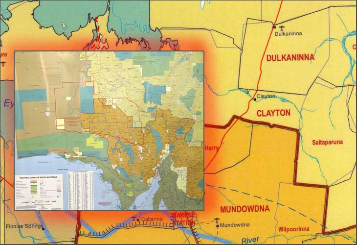
PASTORAL AREAS OF SOUTH AUSTRALIA WALL MAP:
Produced by Dept of Land, Water and Biodiversity Conservation, March 2007.
Colour
Laminated
102 cms wide by 85 cms high.
Index of 225 property names shown
Grid reference and area in square klms.
SCALE: 1:250,000
Information shown on the map
 Sheep Stations and boundaries of the bigger blocks Sheep Stations and boundaries of the bigger blocks
Cattle Stations and boundaries of the bigger blocks
National Parks
Conservation Reserves
Aboriginal land
Roads
Rail
Dog Fence
Prohibited areas
Homestead Positions
PLEASE NOTE: The Eyre Peninsular is not well represented for property names.
PRICE: $50.00 plus postage
|
Price: $50.00 plus Postage
HOW TO ORDER THIS PRODUCT:
You can order this product simply by contacting Alick Maps via phone 0412550205 or by Email, CLICK HERE.
Terry or Rosemary will retain your particulars and inform you of how you can pay for the item.
Once your payment has been cleared your product will be dispatched using suitable approved Aus Post packaging.
|